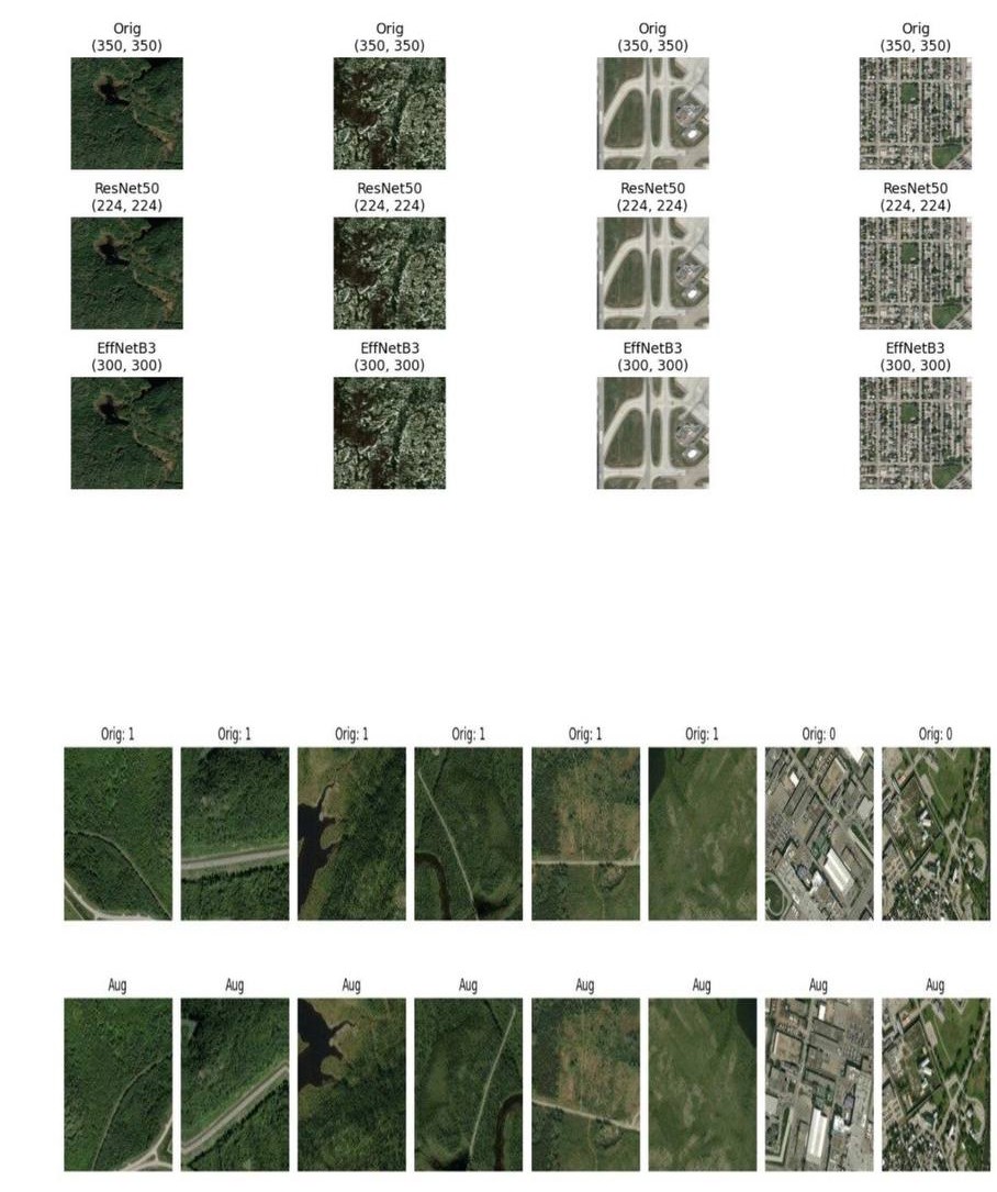
Data augmentation and image resizing applied to the satellite images before training the models.
A deep learning system that classifies satellite images as wildfire or no wildfire. The models were trained on more than 36,000 images using TensorFlow and Keras.
I compared a baseline CNN with transfer learning models (ResNet50, EfficientNetB3, and EfficientNetB0) and selected EfficientNetB0 for its balance of accuracy and inference speed. The final model reached 96% accuracy and a 0.97 F1-score. Using Grad-CAM and confusion matrices, I found that most errors happened in urban and industrial areas.
The model is deployed in a Flask web app where users can upload an image and see the prediction with a Grad-CAM heatmap.
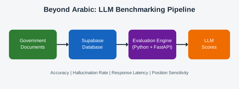
The Beyond Arabic pipeline, from collecting Arabic documents to evaluating Large Language Models.
A benchmarking framework that evaluates Large Language Models (LLMs) on long Modern Standard Arabic documents.
The framework tests models on information retrieval, multi-hop reasoning, question answering, and conversational memory. A data pipeline collects documents from official government sources and stores them in a Supabase database. A Python evaluation engine connected to FastAPI measures accuracy, hallucination rate, response latency, and position sensitivity.